To be listed on the CAMPOSOL TODAY MAP please call +34 968 018 268.

Guidelines for submitting articles to La Manga Club Today
Hello, and thank you for choosing La Manga ClubToday.com to publicise your organisation’s info or event.
La Manga Club Today is a website set up by Murcia Today specifically for residents of the urbanisation in Southwest Murcia, providing news and information on what’s happening in the local area, which is the largest English-speaking expat area in the Region of Murcia.
When submitting text to be included on La Manga Club Today, please abide by the following guidelines so we can upload your article as swiftly as possible:
Send an email to editor@lamangaclubtoday.com or contact@murciatoday.com
Attach the information in a Word Document or Google Doc
Include all relevant points, including:
Who is the organisation running the event?
Where is it happening?
When?
How much does it cost?
Is it necessary to book beforehand, or can people just show up on the day?
…but try not to exceed 300 words
Also attach a photo to illustrate your article, no more than 100kb

How liable is your area of the Costa Cálida to flooding?
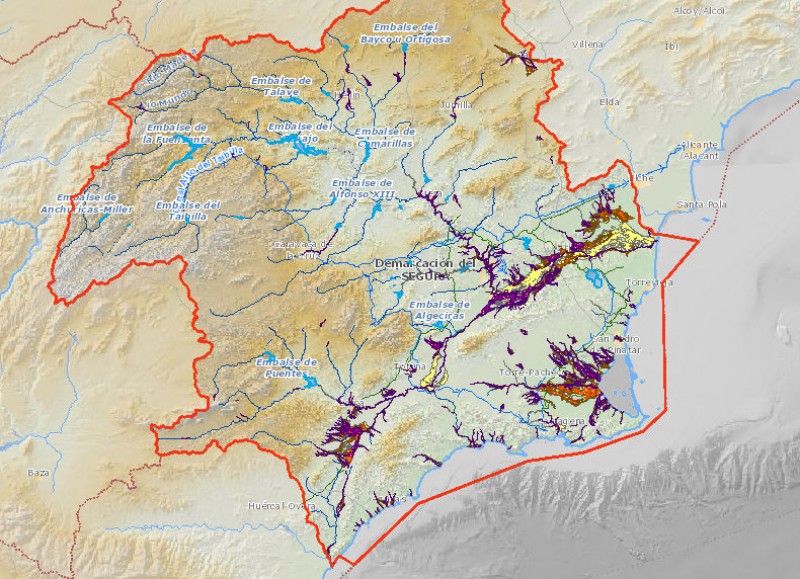
An online tool shows the "floodability" of the entire Segura basin in detail
As the threat of torrential storms looms large in the Region of Murcia, with a red alert for possible downpours in place on 12th and 13th September and authorities cancellaing school and warning people to take precautions, it is worth checking how prone to flooding your particular area is on a fascinating "floodability" map compiled by the CHS water authority.
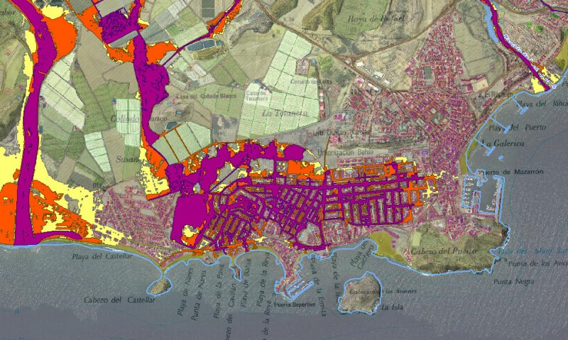
The map clearly shows how in the east of the Region water runs off the flat land of the Campo de Cartagena towards the Mar Menor, as well as how the Guadalentín valley between Lorca and Puerto Lumbreras and the flood plain of the Segura are liable to being affected by floodwater. The map also goes into incredible detail as you enlarge the image, showing clearly how the streets of Puerto de Mazarrón are not served by adequate drainage in the Bahía area, while in nearby Bolnuevo the risk presented by the rambla, which overflowed disastrously almost excactly 30 years ago, is clear to see.
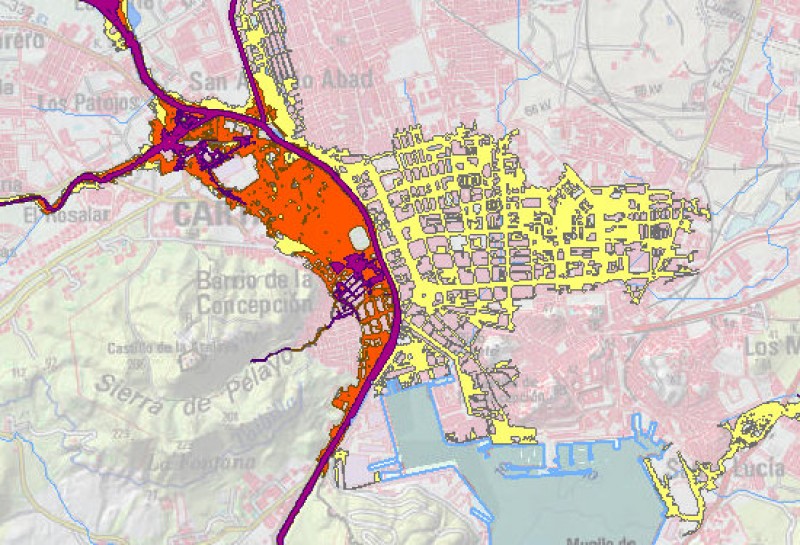 Interestingly, the map of Cartagena reflects the area of land in the north of the city which is low-lying, having been reclaimed from the sea as the city expanded: the original peninsula on which the ancient cities of Qart Hadasht and Carthago Nova stood is relatively risk-free!
The CHS map can be found here: click here.
Click here to see the map and understand which parts of Murcia are most vulnerable to flooding over the next two days!
Join the Murcia Weather Watch group on Facebook to keep up to date with all the latest forecasts and weather related stories: https://www.facebook.com/groups/RegionOfMurciaWeatherWatch/.


