


PROPERTY SEARCH


Arctic air mass brings winter chill: Spain weekend weather forecast Dec 18-21
Temperatures are set to plummet across Spain as astronomical winter begins
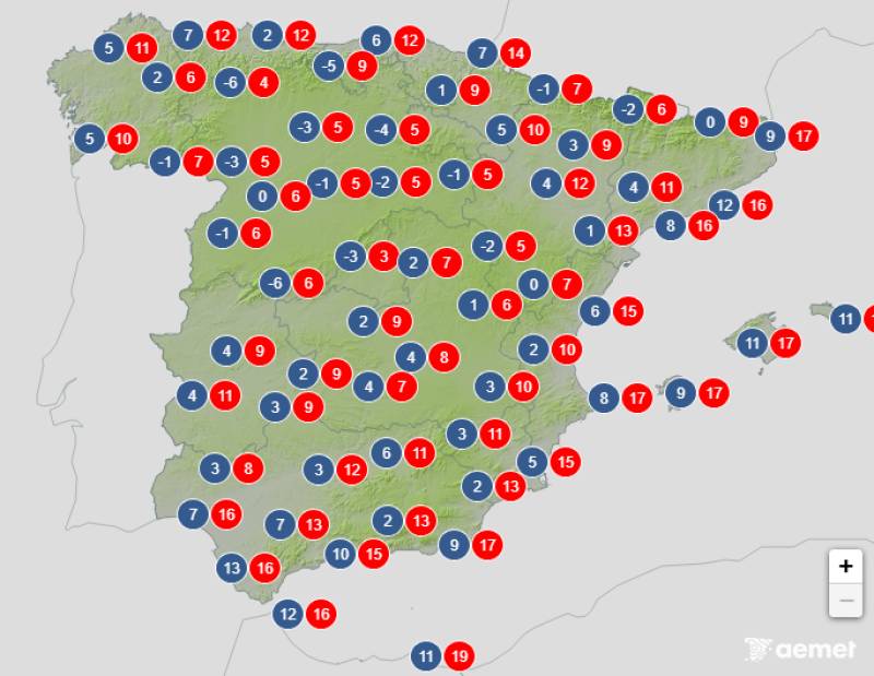
Average temperatures expected on Sunday December 21
Spain is bracing for a proper taste of winter this weekend as a mass of Arctic air moves in, coinciding with the start of astronomical winter on Sunday December 21 at 4:03pm. The arrival will bring plummeting temperatures, widespread snowfall and strong winds across much of the country.
Two successive Atlantic weather fronts will sweep across Spain over the coming days, bringing significant rainfall and transforming mountain ranges into winter wonderlands. The wind factor will make the cold feel even more biting, particularly when gusts are at their strongest.
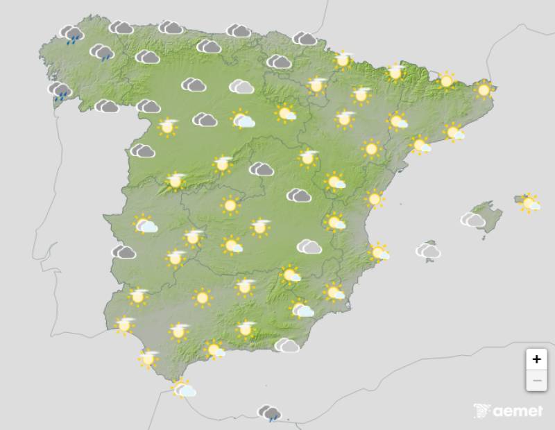
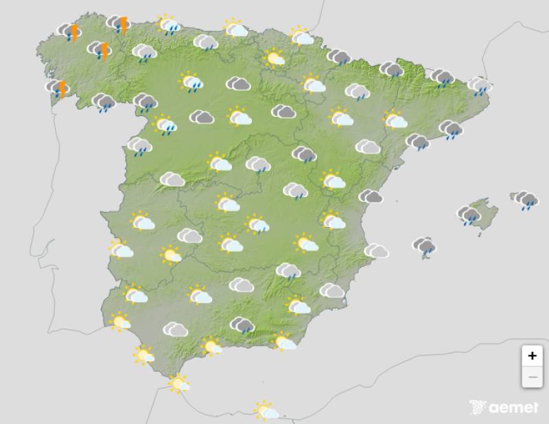
Weather outlook on Thursday December 18
The first Atlantic front reached Galicia on Thursday December 18 but it will soon start tracking towards the Mediterranean, bringing rain in its wake. The western regions will see the heaviest downpours, whilst eastern areas should experience more isolated showers.
By Friday December 19, temperatures will already be noticeably dropping in many parts of Spain as the front brings rain to the south, affecting Andalucia, Ceuta, Melilla and the north of the Canary Islands. The cooler conditions will mark the beginning of what promises to be a decidedly chilly weekend.
Weather outlook on Friday December 19
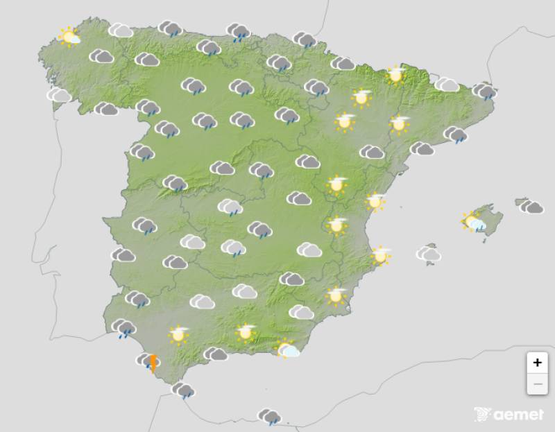
Rain is expected to reach the Mediterranean by Saturday December 20, again affecting eastern Andalucia, Murcia, the Balearic Islands and Catalonia. The Valencian Community will see more isolated showers rather than sustained rainfall.
Saturday afternoon will bring a new frontal system slipping through Galicia, this one associated with a more compact low-pressure system descending from the north with a greater isobaric gradient. The system will bring rain sweeping from west to east across the country, accompanied by intensifying winds and increasing waves on the northwestern coasts first, then spreading to the Canary Islands and other Mediterranean areas.
Weather outlook on Saturday December 20
Capital cities will start seeing single-digit maximum temperatures, with highs remaining below 10°C in many locations. Only parts of eastern and southern Spain, along with the Canary Islands, will manage to exceed 15°C.
Sunday December 21 will see the most dramatic temperature drop as the second front's effects fully take hold. These air masses are of Arctic origin but maritime in nature, meaning they'll bring significant moisture along with the cold, though not quite as frigid as continental Arctic air would be.
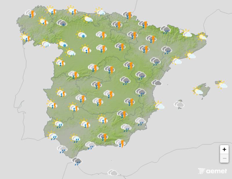
Weather outlook on Sunday December 21
Temperatures will fall several more degrees, with the wind making conditions feel even colder, particularly in southern and southeastern areas where westerly winds will be especially intense. The Strait area, the Alboran Sea and the coasts of the southeastern peninsula and Balearic Islands will experience particularly strong westerly winds.
Rain will spread from the west to large areas of eastern Spain, the Balearic Islands, Ceuta and Melilla. The Canary Islands will already be under the influence of high pressure, bringing more stable weather conditions to the archipelago.
As the colder air mass moves in, the snow level will gradually descend across the country. In the northern half of Spain, snow could accumulate above 600 to 700 metres, while in central regions the snow level will sit closer to 900 to 1,000 metres.
The Pyrenees and Cantabrian Mountains will see the most significant accumulations, transforming into proper winter landscapes. A good number of provincial capitals in the northern half of the country, particularly those in Castilla y León, will witness snowfall over the weekend.
Join our Spain Weather Watch Facebook group for all the latest weather and climate change news
Images: Aemet


Sign up for the Spanish News Today Editors Roundup Weekly Bulletin and get an email with all the week’s news straight to your inbox
Special offer: Subscribe now for 25% off (36.95 euros for 48 Bulletins)
OR
you can sign up to our FREE weekly roundup!
Read some of our recent bulletins:
Discount Special Offer subscription:
36.95€ for 48 Editor’s Weekly News Roundup bulletins!
Please CLICK THE BUTTON to subscribe.
(List price 3 months 12 Bulletins)
Read more stories from around Spain: